Smarter Farming with Compaction Mapping
Compaction is a growing problem in farming, especially as modern farming equipment has gotten heavier. As machines move across farmland, the soil is pressed down. This damages soil structure, decreases pore space, limits water holding abilities, and impedes root development.
While improving soil health can help combat compaction, the most effective defense is to reduce compaction altogether. This can be achieved through PIPE AG’s smart farming capabilities.
In addition to tracking combine capacity, grain cart weights, and truck locations, PIPE AG utilizes modern GPS and satellite technology to create compaction maps. This allows farmers to keep their equipment on the same paths, greatly reducing compaction and protecting their soil. To learn more about what PIPE AG can do for your harvest season, click the button below:
The harvest season poses the biggest threat of compaction; especially if the ground is wet. Combines and grain carts move across the soil over and over, pressing it down and disrupting structure. Studies show that 80% of compaction happens in the first pass. When additional passes are made across the same path, little additional compaction occurs.
This means farmers and operators should try to keep machinery operating in the same lanes as much as possible.
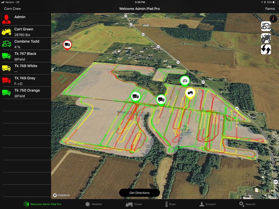
While everyone thinks their grain cart paths look like this:

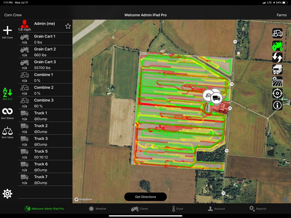
Their harvest season actually looks like this:

PIPE AG leverages modern smart farming technology to address this issue directly. With our compaction map functionality, farmers can take control of their compaction. In addition to creating and following traffic patterns, PIPE AG’s software also keeps track of how much weight is on grain carts, all in real time. This helps operators make intuitive decisions in the field during harvest.
The weight-based compaction map can even be used for variable rate tillage after harvest!
More Than Compaction Mapping
While compaction mapping is a critical tool for modern farmers, it’s only one of the many smart farming features PIPE AG has to offer. Our product was created by farmers, for farmers to take the guesswork out of the harvest season.
With PIPE AG, farmers always know where their equipment is at and how full it is. Built-in GPS technology allows for Touch&Go Directions, guiding vehicles to locations that are otherwise impossible to find. Best of all, PIPE AG was specifically created to work with all major brands of farming equipment. It also integrates seamlessly with other farming software such as Libra Cart/Agrimatics and iFarm.
Despite all of these features, PIPE AG is incredibly easy to understand and use. For a smart farming tool that greatly simplifies the harvesting process, you can trust in PIPE AG.
